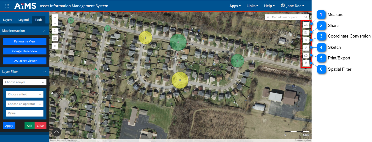
Navigation: Make a Map > Work with Map Toolbar The Map toolbar is a vertical toolbar located on the right side of the map. It contains a number of tools you can use with the map. Review the table beneath the illustration for an explanation of the callouts. Measure Allows you to measure distance and area. For details, see: Measure Distance and Measure Area. Share Creates a URL of the current configuration of map data so you can share it with others. For details, see: Share Data. Coordinate Conversion Lets you determine the coordinates of a location or find a location based on geographic coordinate values. For details, see Coordinate Conversion. Sketch Lets you place shapes and text on the map as annotations. For details, see Sketch. Print/Export Lets you generate a printable document. For details, see: Print/Export Spatial Filter Lets you draw a polygon, rectangle, or circle to include only the assets within those shapes. Copyright © 2026 Cultivate Geospatial