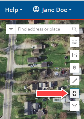
Navigation: Make a Map > Work with Map Toolbar > Print/Export The Export tool generates a printable map document. Maps can be exported in a number of file formats, including PDF, PNG, JPG, GIF, TIFF, and more. The Export icon is located in the upper right corner of the Map Viewer application. There are three Print/Export options. Click the links below to explore how to use the options: •Layout: Uses City of Columbus templates that include a title, legend, legal disclaimer information, author, date, and AIMS branding materials. •Map Only: Generates only the map image, which is useful for embedding into other medium. •Exports: Lists exported maps for download for a brief period of time. Copyright © 2026 Cultivate Geospatial