The Layout option uses one of the included map templates that are designed to conform to the City of Columbus branding guidelines.
Follow the numbered instructions beneath each illustration to export the map with a template.
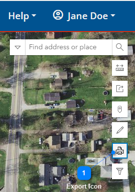
Export Icon
Select the Export icon to view the Export dialog and select the Layout tab.
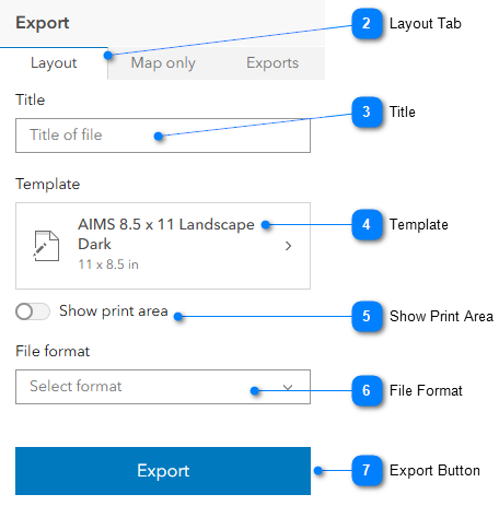
Layout Tab
This tab lets you select the layout for the map.
Title
Enter a title that is brief, but descriptive. NOTE: The Title is used as the file name when the map is exported.
Template
Select one of the two City of Columbus branded map templates from the drown-down list:
•AIMS 8.5 x 11 Landscape Dark
•AIMS 8.5 x 11 Landscape Light
Show Print Area
If you turn this on, the map will show only the area that will be displayed in the template; the rest of the map on the screen will appear dark.
File Format
Select a file format from the drop-down list:
•AIX
•EPS
•GIF
•JPG
•PDF (default)
•PNG32
•PNG8
•SVG
•SVGZ
•TIFF
Export Button
Select Export to generate a file in the format specified in the File format field. The name of the file is the name provided in the Title box. NOTE: Once you click Export, the Exports tab automatically opens where you can then look at the file and download it. For details, see: Print/Export: Exports.