|
Filter by NLFID filters data from the selected layer(s) that intersects with a selected predefined route, identified by an NLFID.
1.Make sure the Condition Map is visible with the appropriate layers turned on .
2.Position the map to the desired location by panning and using the map tools to zoom in or out.
3.Select the Filter by NLFID icon: 
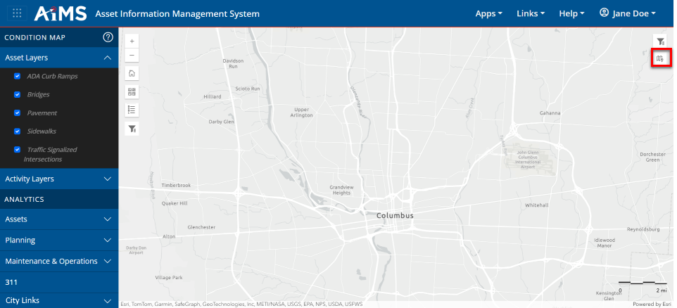
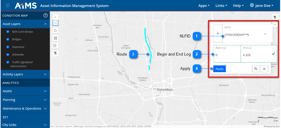
4.The NLFID pop-up window opens. Fill in the fields by following the numbered instructions beneath this illustration.
|

|
NLFID
|
|
From the NLFID pop-up window, begin typing the characters that make up the NLFID; the drop-down list will automatically populate with NFLIDs starting with those characters.
•Select the appropriate NFLID from the drop-down list (in this example: CFRACR00009**N). The route will highlight on the map. NOTE: You must select the NFLID from the list; you cannot type the entire value in the field.
•Once a NFLID is chosen, the drop-down list will show only that NFLID. To choose a different NLFID, you must delete the current NFLID using the backspace key.
|
|

|
Begin and End Log
|
|
The Beginning and Ending markers automatically populate once you select an NFLID.
|
|

|
Route
|
|
The route identified by the NFLID appears highlighted on the map
|
|

|
Apply
|
|
Once you select the correct NFLID, click Apply. The map will zoom to the route and the map will be filtered to the features along that route.
|
5.You can also refine your search by NFLID by specifying marker numbers (Begin Log and End Log). To do so, make sure the NLFID pop-up window is still open and follow the numbered instructions beneath the illustration.
.png)
|
-number-1.png)
|
NFLID
|
|
Select the NFLID from the drop-down list. Its Beginning and Ending marker numbers automatically populate and the route appears highlighted on the map.
|
|
-number-2.png)
|
Updated Marker Numbers
|
|
Refine your route segment filter by entering different Begin Log and End Log numbers to define a specified section of the route. Here, we have changed the End Log value from 4.328 to 3.
|
|
-number-3.png)
|
Updated Route
|
|
The updated route is highlighted. Here you can see it is shorter than it was in Step 4.
|
|
-number-4.png)
|
Apply
|
|
Once you select the correct NFLID, along with specific Begin Log and End Log values, click Apply. The map zooms to the section of the route and the map is filtered to display only the features along that section. Notice that in this example
|
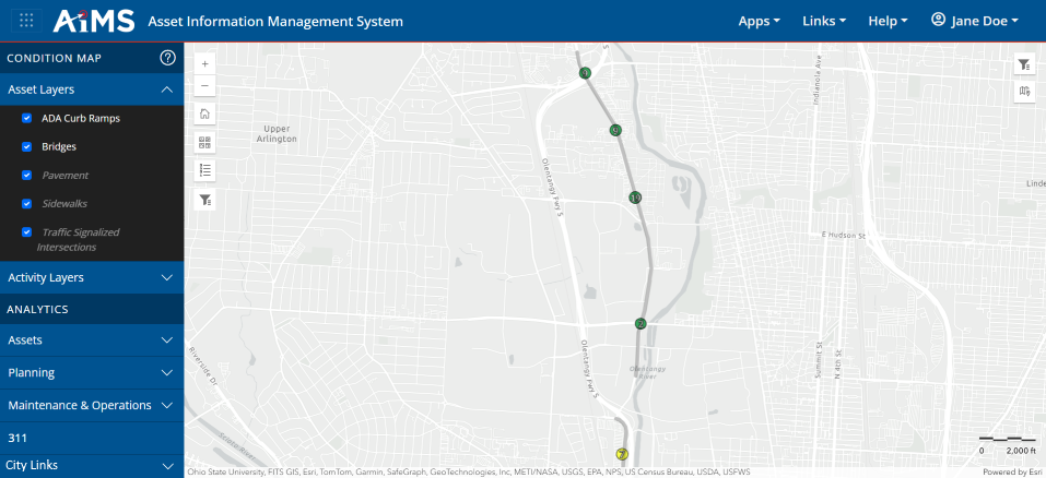
6.The results will look something like this, where the filtered features are visible.
NOTES:
•If you want to save the NLFID filter and use it in the future, see: Save Attribute and Spatial Filters.
•If you want to clear the NLFID filter and start over, click Clear Spatial Filters: 
|

