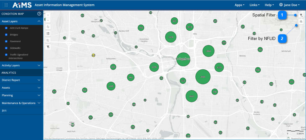
Spatial filters can also be applied within the Condition Map. NOTE: These filters apply to any reports you later generate during the session.
The table beneath the illustration explains the numbered callouts for the spatial filtering icons on the right side of the map.
Spatial Filter
Expand this icon to view a horizontal toolbar that lets you: (a) draw a polygon, (b) draw circle, or (c) rectangle on the map to filter data, (d) filter by map extent, (e) clear any spatial filters that were defined, or (f) zoom into the filtered selection: (a) (b) (c) (d) (e) (f)
Filter to the records contained in a specified map extent.
Filter by NFLID
Click this icon to filter data based on features that intersect selected route features.