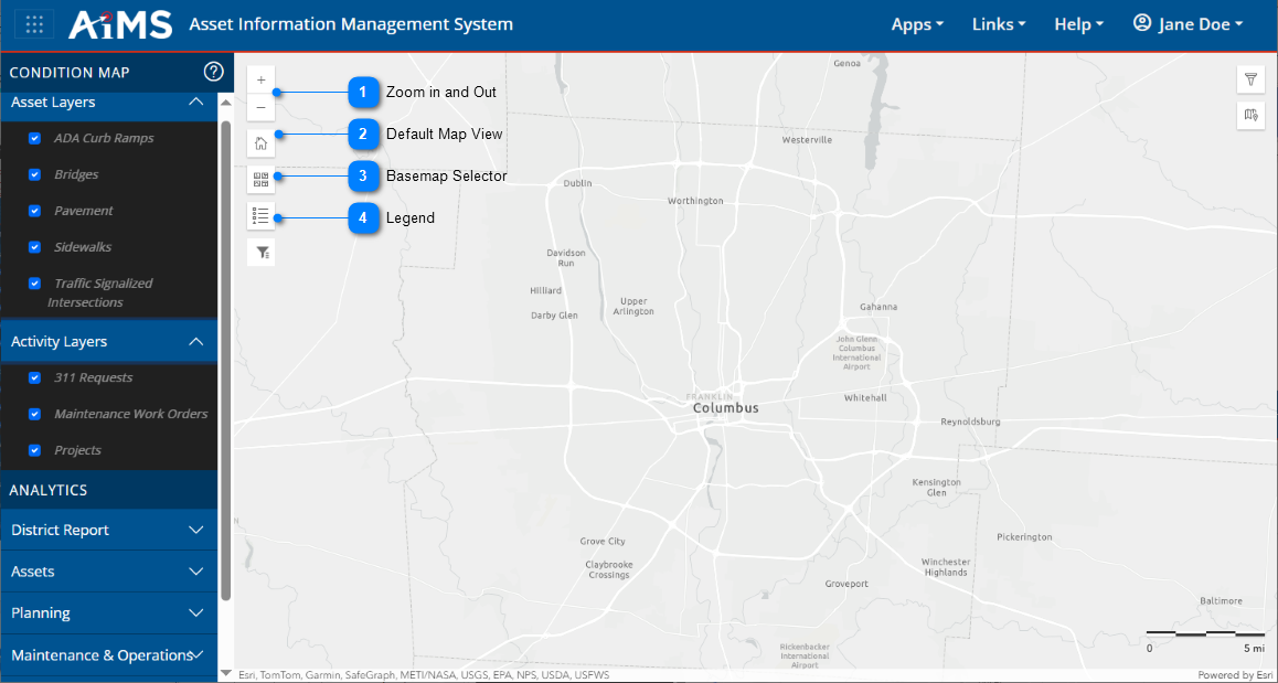
You can use various navigation tools to better view the Condition Map.
Use most of the icons on the left side of the map for navigation purposes. The table beneath the illustration explains the numbered callouts.
Zoom in and Out
Click the + and - icons to zoom in and out of the condition map. NOTE: You may also zoom by rotating the scroll wheel of your mouse or by pinching and spreading your fingers on a touchpad.
Default Map View
Return to the default extent of the condition map, showing all of the city of Columbus.
Basemap Selector
View a drop-down gallery of basemaps.
•Click the desired basemap to change the map displayed.
•Click the icon to close the gallery of basemaps.
Legend
View an interactive legend of the Condition Map.
•The legend contains only the symbology for visible layers.
•If you see No legend when you click this tool, you must zoom in on the map and/or turn layers on in the left panel.




.png)
.png)

.png)