|
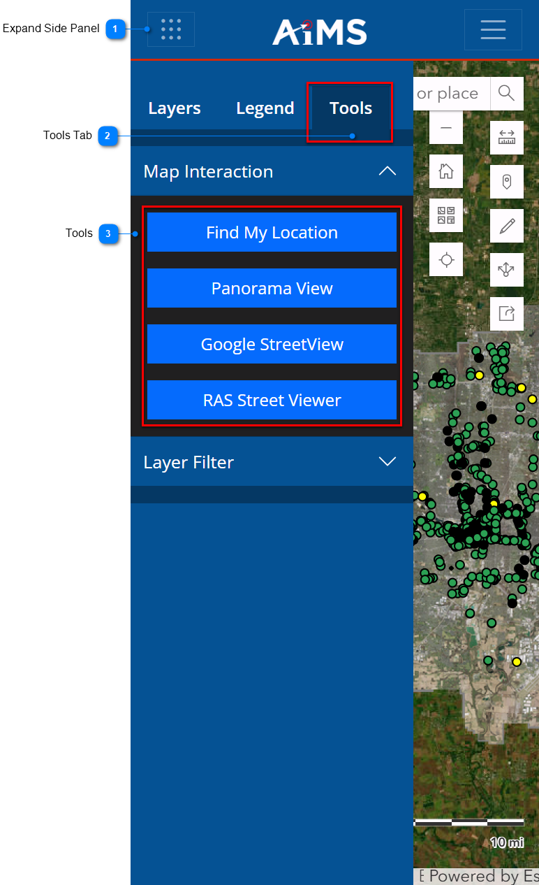
The Tools tab contains a series of interactive tools that allow you to select different views from external sources that open up in a new tab outside of Map Viewer. They can also find their current location on the map.
Follow the numbered instructions beneath the illustration to display the various tools.
|

|
Expand Side Panel
|
|
Tap the waffle in the upper-left corner to expand the side-panel.
|
|

|
Tools Tab
|
|
Tap the Tools tab, if necessary.
|
A. Find My Location
The Find My Location tool lets you zoom into your current location on the map.
1.Tap Find My Location
.png)
2.Click the waffle to collapse the sidebar. The map pans and zooms to your location on the map. NOTE: If the map does not pan and zoom to your location, you may need to grant the mobile browser application permission to use your device's location services.
.png)
B. Panorama View
The Panorama View tool lets you select a location on the map and then view the street view of that location next to the map.
1.Tap Panorama View.
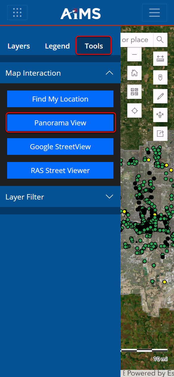
2.Tap the waffle in the upper-left corner to collapse the side panel and then move the cursor to a location on the map and tap.
3.The Panorama View opens as shown below.
.png)
3.To close the Panorama View, simply tap the X.
C. Google StreetView
The Google StreetView tool lets you select a location on the map and then open its street view in another window or browser tab.
1.Tap Google StreetView.
(1).png)
2.Tap the waffle in the upper-left corner to collapse the side panel and then move the cursor to a location on the map and tap.
3.The Google StreetView opens as shown below.
.png)
4.To close the Google StreetView, simply tap the X.
D. RAS Street Viewer
The RAS Street Viewer tool is an external application provided by City of Columbus. It displays images of any location within the City of Columbus boundary. If you need access to areas outside of this boundary, use the Panorama View or Google StreetView tool.
1.Tap RAS Street Viewer.
(2).png)
2.Tap the waffle in the upper-left corner to collapse the side panel; then move the cursor (a large "+") to a location on the map and tap.
3.The RAS Street Viewer opens as shown below. The numbered callouts after the illustration describe the panes in the RAS Street Viewer.
.png)
|
|
Pane 1
|
|
Map view of the location you selected. You can zoom in or out, display different layers, turn on and off the Google street view.
|
|
|
Pane 2
|
|
Google street view of the location you selected.
|
|
|
Pane 3
|
|
Left camera view of the location you selected.
|
|
|
Pane 4
|
|
Right camera view of the location you selected.
|
|
|
Pane 5
|
|
View of the pavement condition.
|
NOTE: To exit the RAS Viewer, simply close its browser tab and return to the map.
|


